Larapinta Trail blog, Central Australia | April 2012
Hunh?
The Larapinta Trail?
OK, so this isn’t the South Island, or even further south, but I might as well pop it on the website because, well, why not, at 232 km it is at least “almost epic”—the usual time to complete is around 17 days due to the spacing of the camping areas.
For your average casual tramper this has to be one of the best walks in Central Australia, well, Australia.
Here’s why:
the Larapinta is maintained, often;
it’s well marked, usually, except where it’s not, ie, where recent bushfires have raged through and they haven’t replaced the trail markings, yet, due to budget cuts;
there’s excellent purpose-made maps available complete with the day’s terrain guide;
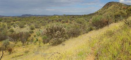
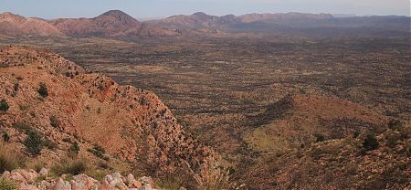
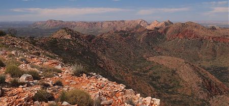
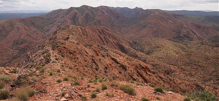
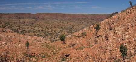
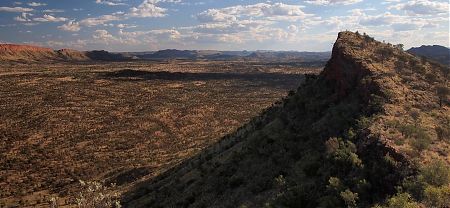
it’s intense, amazing, wacky scenery and you often walk along open ridges with extensive views;
you get to visit many of the major West McDonnell Range National Park features, ie, Simpsons Gap, Stanley Chasm, Ellery Big Hole, Serpentine Gorge, Ormiston Gorge, Redbank Gorge, Mt Sonder, etc, but often from a different direction from the standard-issue, see-everything-in-a-day-style tourists;
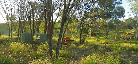
official secure food dump lockers where you can pick up your pre-deposited food drops, you can even organise that with a local who offers the service; the good, and sometimes great, campsites;
water at every campsite, except one where you have to lug it in on your back for a few hours;
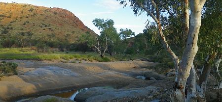
the finale, the long walk up Mt Sonder, the fourth highest bump in the Northern Territory which, of course, ain’t saying much, but the 360º view up there on the top of the world is totally splendid, if not startling with that remarkable central Australian landscape with its textures and colours;
and then, at the end of your experience, you can arrange for an efficient, if expensive, pickup service if you don’t feel like taking the less costly option, ie, free, of hitching a ride back with the goggle-eyed tourists in their rental vehicles.
Basically it’s magnificently setup but there’s always that parallel tourist road fallback not so far away, a few hours walk generally if you’ve experienced the trail with full sufficiency.
This is my tale …
Wandering the Larapinta | ebook
This blog has been converted to a 15,000 word ebook, Wandering the Larapinta. There are prunings and additions to the original blog text to make it read more, umm, book-like. You can download it at Amazon.

By the time I’d marched into town with that humungous pack on my back I was soaked. My shirt was wringing wet, there were even riverlets through my undies.
Nice walking but lugging this load I’m taking my time.
No hurry.
No hurry at all.
It was the boys first day and they hadn’t worked out if they were having fun yet.
Cheers rang out when I produced a lost antenna for their 2 way radio, they were that kind of organised.
“If I find anything else I’ll just send it to Drew, c/- Newcastle.”
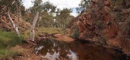
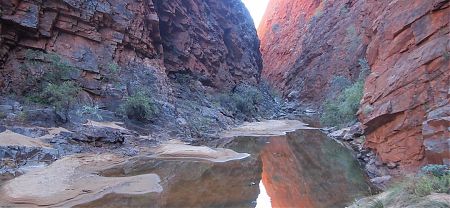
Highlight of the day: the frog plague at Spring Gap.
The pond was too small to contain fish to eat the tadpoles so when I went down to the water each footstep had an explosion of five or so little fingernail sized frogs, remarkably camouflaged, ricocheting off in all directions.
There were hundreds of the minute leaping critters, I beat a slow retreat.
Nuthin’ day.
Not much at all.
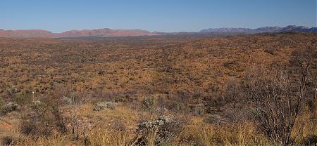
I had a scrumptious lunch, a handful of raisons, and sat around with that tremendous view of the Chewings Range, sun flitting out spasmodically, it’s rugged as, gashes of rock, just a madman’s creation really, make it as mountainous as you can with the harshest jagged slices of rocks on edge, cliffs, or near vertical surfaces, she’s mighty rugged.
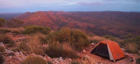
There’s an official campsite up here, of a sort, hacked out in the midst of the rocks, for the intrepid. It’s been pretty windy, almost blowing me off the edge, but it’s calmed a bit and there is one decent site, verging on the horizontal, on fine gravel, scratched on the lee side.
Looks like a great spot to perch and watch the sunset.
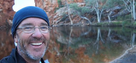
I like to feel that I have really experienced these places, I’m sure not coming back.
Today I mucked around on the top, then later on down at Stuarts Gap, where everyone camped last night, I wandered up the unnamed creek bed for half an hour and found a pond full of tadpoles and frogs sunning themselves on a rock before returning.
I’d hate to race past all that.
It’s a wondrous experience travelling through this ahistoric landscape, time stands still out here, these little waterholes, I’ve a new appreciation for Central Australia thanks to this excursion into the West MacDonnell Range.
The sun has just gone down over the nearby ridge, maybe the flies will sense it’s time to take a break.
I’ve had some experience in trail finding over the years, not always blazing my own, but as in life, I parted ways with the accepted trail and, well, just crashed on until some evidence of the trail presented itself, or, occasionally, I backtracked and chose another route. For me it all worked out well enough, maybe five minutes in total looking for the trail but others wrote in the log books of spending hours extra on this section.
The most scenic sections of the entire trail with the exception of the last, climbing Mt Sonder, been there, done that, twice, have been traversed.
But that’s it for me.
12 days on the trail. Time to do something else. I’ve come 126 km of the 232 km full trail.
Overall it’s been much more scenic, more interesting, more challenging than I had anticipated.
A quiet last evening camped out at my endpoint of the trail with an unexpected visitor at close range: lying in my tent with eyes shut I sensed something else living was about and found a stray dingo just trotting past not 3 m away.