Larrikin Creek direct!
It started well, I was away early enough.
My boots were still wet from yesterday, so with the thought I would have some wading in the unnamed creek I just powered up the Matiri River to the turnoff, a couple of quick splish-through crossings required.
Then the creek turned out to be easy enough, a few fallen trees to get over but the top third was dry and had only a few clambering situations. The rock was generally mudstone, decent grip when dry, slippery when damp. Today was no issue but the creek after rain would be fearsome.
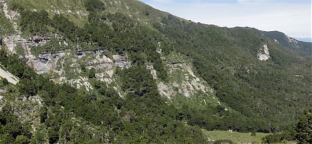
I was able to get good views of possible climbing trajectories, in between bluffs, at least for the first 250 m. I chose the most obvious, straight up from the creek, an option was to go onto the next ridge, or even follow the creek right up but there was a waterfall shown on the map, they can be tricky to get around.
The full frontal attack was the way to go.
After the first 20 m or so of scrub bashing/smashing the undergrowth thinned and while it was still steep, handholds required, I managed to power up without too much issue.
Lunch at the top, that’s decent progress for the morning.
There was a flattish spot and then a good view of the next climb. According to my GPS it was a further 330 m but a more gradual slope. Shouldn’t be excessively bad.
There was a decent sized clearing to cross, all tutu, and I’m surprised to see so many deer footprints, there is an actual deer highway to cross. Suddenly a deer barks, more or less like a large dog, and there’s plenty of crashing in the undergrowth, that’s the second deer heard, but not seen, for the day.
The second climb begins but it’s not comparable to the first. It’s considerably more scrubby, often I have to push through with my arms, swimming style, where have I done that before this summer, but this is way steeper.
Occasionally I get on a deer trail for a few metres but they don’t last. Overall it’s the steepest, most physically demanding full-body workout for the summer, I’m constantly assessing which direction to take to avoid the worst of it. There are bluffs around.
I just have that thought that another step is one less that I have to take.
Dunno, I’ve delayed this kind of activity to a late stage in my career, I’m not gonna do too much more of this cross-country style adventure, trackless, I resolve.
Despite all this, I’m quite enjoying myself, the zaniness of it all.
Physically I’m feeling OK, I’ve become quite fit through my various walks over the summer.
Eventually, 3.5 hours after lunch I make it to the ridge. So much for my thought, it wasn’t going to be so hard.
As I get to the top it all opens out in front, not a cloud now, nor much breeze. Just below, 200 m down, is the 1000 Acre Plateau looking particularly plateau-like, a flat plate with a big drop over the far edge. There’s the south branch of the Mokihinui River.
It’s just amazing.
I sat up there for an hour taking it all in, well, actually also making use of cell phone connectivity.
Finally, I notice it’s six pm, time to go.
This time rather than scrabbling through scrubbery I decide on the scree slope that descends in a big hurry, then turns into a steep creek.
I thought this side wouldn’t be as steep, but it still looks sufficiently inclined to keep me nervously thinking. Mostly it’s okay, but when the water appears there are moments of concern. Some I climb around, a couple of times I hang onto the flax and do it sitting down.
Yeah, it was good to see an official DOC track once more, with snow pole markers, another hour to the hut.
She was a big day, just under 12 hours start to finish.
I made a pledge to stay on the tracks for the rest of the summer.
A guide to the night’s accommodation: Larrikin Creek Hut