Wasp sting!!
On my left calf. Man, there isn’t much flesh left exposed between my rather long shorts and my excellent gaiters.
Moments later, whammo!! This time on a matching spot on my other calf.
The hut was only two minutes away, almost in sight. That’s given a rosy glow to my lower limbs.
Another one of those all-day-to-get-5.5-hours-of-walking kinda days.
It was sure interesting, the permolat markers giving the day a real 1980s feel. Also there was massive deer sign the whole way, both recent tracks in the forest, and later, on the sandy river beds. In many cases when I say recent I mean it looks as if they had vacated the environs in a hurry because of my presence.
Somewhere I read that because the deer can’t make it up onto the tops because of the bluffs the helicopters don’t do so well, there’s not a lot of open countryside except for the slips and the riverbed.
There was a significant stretch, maybe 800 m of track through the rampant tutu and there’s not enough traffic to smash it down. I did my best but that helps the next lot, not me.
Overall the track was well marked, and the last hour or two has been recently recut.
Lake Jeanette still had the dead trees from when it was created by the 1929 Murchison earthquake, and a few noisy paradise ducks doing their thing. There were sporadic birds, a robin or two, bellbirds, a noisy tui, and a parakeet not far away doing its chatter thing. Overall there’s a feeling of many fewer birds this side of the range where the last 1080 drop was 2008. There’s definitely possums around.
Then later, once I made it down to the recently cut track, I’ve decided to wander down the river, the valley was wide enough with the river about as low as it would go. Often it was just standard gravel bashing, but there was some rock hopping, down a short but easy enough gorge, a few crossings and, almost, my undie rinsing. It was quite fun and certainly more interesting than climbing up and down steep slopes in the forest.
Undecided about tomorrow I started by thinking I’d just go down to the Lake Matiri Hut, five hours away, then go up to the 1000 Acre Plateau but, later, I’ve been looking at the map more closely and may in fact do my last bush bash directly to the top hut, Larrikin Creek. That would involve heading back up the valley for half an hour and taking to a fairly substantial creek for just over a couple of kilometres at which point I would charge directly up the hill for 250 metres elevation gain, there’s a short flat bit, then another 350 m or so.
Once on top of the ridge, it’s sounding easy now, you just drop 200 m down the other side and you are on the actual 1000 Acre Plateau with an hour stroll to the Larrikin Creek Hut.
I’ll see how I feel in the morning, depending on what the weather is like.
My pack is obviously much lighter these days, I’ve been going more than a week and I fear it’s almost one of those now or never times.
This seems like a trip where the Little Adventures keep on coming.
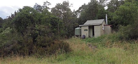
A guide to the night’s accommodation: McConchies Hut